
- Home
- Surveying matters
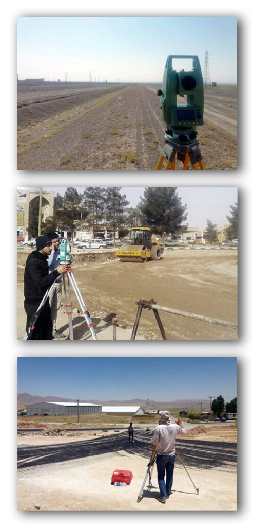
Surveying matters
Specialized studies and supervision of surveying projects
The surveying department of Sepahan Comprehensive Consulting Engineers has been active in all fields of surveying since its establishment, and due to its history in this field, expert staff, and advanced surveying equipment, it has succeeded in obtaining the 1st level of surveying specialization.
This consulting engineering firm is ready to provide services in the following fields:
1. Preparation of regional, urban topographic maps and routes in all scales, including executive scales (1:100, 1:200, 1:500 maps and ASBUILT maps) and study scales (1:1000, 1:2000, etc.).
2. Preparation of urban and non-urban cadastral maps.
3. Preparation of maps of urban roads and intersections.
4. Surveying of water lines and power transmission lines.
5. Preparation of longitudinal, transverse profiles and route plans of roads, including roads and railways.
6. Executive leveling in all construction projects.
7. Surveying of large bridges.
8. Surveying of tunnels, mines and dams.
9. Conducting aerial imaging operations using unmanned aerial vehicles (UAVs).
10. Preparing river cross-sections
11. Mapping underground facilities.
12. Monitoring the mapping of construction projects.
Click to view the featured projects in this section
Summary of the consultant's background in surveying matters

| Project title | Contract date | Employer |
|---|---|---|
| Providing surveying services, preparing and drawing the maps required by Article 54 of the Law on Removing Barriers to Competitive Production and Improving the Country's Financial System, and operationalizing all its executive processes. The issue of eliminating interferences resulting from the implementation of parallel regulations of the Agricultural Jihad within the city of Hamedan. | 2025/03 | Hamadan Province Agricultural Jihad Organization |
| Preparing a base map of part of the Yasuj city area | 2024/09 | General Directorate of Roads and Urban Development of Kohgiluyeh and Boyer-Ahmad Province |
| Conducting mapping operations in Isfahan province schools | 2024/04 | General Directorate of Renovation, Development and Equipping of Schools in Isfahan Province |
| Providing surveying services, preparing and drawing the maps required by Article 54 of the Law on Removing Barriers to Competitive Production and Improving the Country's Financial System, and operationalizing all its executive processes. The issue of eliminating interferences resulting from the implementation of parallel regulations of the Ministry of Agricultural Jihad within the limits of Hamedan city. | 2024/01 | Hamadan Province Agricultural Jihad Organization |
| Surveying, preparing and drawing the maps required by Article 54 of the Law on Removing Barriers to Competitive Production and Improving the Country's Financial System and operationalizing all its executive processes. The issue of eliminating interferences resulting from the implementation of parallel regulations of the Ministry of Agriculture within the boundaries of Hamedan, Bahar and Famen cities. | 2023/07 | Hamadan Province Agricultural Jihad Organization |
| Mapping the water supply route to the villages of Enayat Beg and Qarasu and mapping the water supply route to the canals from the Qom ring road | 2022/01 | Qom Province Water and Wastewater Company |
| Surveying and preparing the necessary maps to eliminate interferences resulting from the implementation of parallel regulations of the Ministry of Agricultural Jihad within the boundaries of Bahar County | 2021/03 | Hamadan Province Agricultural Jihad Organization |
| Surveying and nailing the Koshkicheh-Polyacryl axis located in Mobarakeh city | 2014/12 | General Directorate of Roads and Urban Development of Isfahan Province |
| Surveying and nailing six lanes on the Isfahan-Tehran axis | 2014/12 | General Directorate of Roads and Urban Development of Isfahan Province |
| Supervising the surveying operations of the Khuzestan General Directorate (provincial level) projects | 2014/03 | General Directorate of Roads and Urban Development of Khuzestan Province |
| Mapping of the water supply plan for the cities of Marzan Abad and Baladeh | 2013/07 | Mazandaran Province Water and Wastewater Company |
| Mapping studies and studies on organizing and equipping agricultural lands of the Golestan Village Production Cooperative Company, Sadeh and Barzak, Kashan | 2012/07 | Isfahan Province Agricultural Jihad Organization |
| Surveying and studies of the construction plan for grade 3 and 4 irrigation and drainage sub-networks in Dehaqan and Shahreza counties | 2012/05 | Isfahan Province Agricultural Jihad Organization |
| Surveying, designing, and preparing piping profiles for water distribution and wastewater collection networks | 2011/09 | Isfahan Province Water and Wastewater Company |
| Surveying and supplementary studies of the Zanjan-Airport axis, including studies of the non-level intersection of the Valiasr garrison, studies of the temporary design of the non-level intersection at the end of the Zanjan-Airport route, and studies of the supporting structure for the transverse passage of the agricultural water pipe. | 2011/07 | General Directorate of Roads and Transportation of Zanjan Province |
| Mapping studies and determination of the boundary and bed of the Esfarjan River in Shahreza County, Isfahan, with a length of 50 kilometers, and organizational studies | 2011/04 | Isfahan Province Regional Water Company |
| Surveying and supplementary studies of the first and second phases of Zanjan-Airport | 2010/10 | General Directorate of Roads and Transportation of Zanjan Province |
| Surveying and supplementary studies of the first and second stages of the improvement of type (C) rural roads in the areas of Khodabandeh, Abhar, Khormadreh and Ejroud counties | 2010/10 | General Directorate of Roads and Transportation of Zanjan Province |
| Supplementary mapping and preparation of cadastral plan for water supply to Tafresh city and 40 villages along the route from Cheshmeh Haftian | 2010/06 | Markazi Province Regional Water Company |
| Mapping of the Dehloran Rural Complex, Musian, Masir Subsidiary Rural Complex, and Small and Large Industries | 2010/10 | Ilam Province Regional Water Company |
| Complementary surveying and study services for the second phase of the second lane of the Dehaqan-Burojen and Mobarakeh-Majlesi-Burojen axes | 2010/08 | Isfahan Province Road and Transportation Department |
| Mapping of the water supply plan for the villages of Chaleh Mort and Nasuiyeh in Hajiabad | 2008/10 | Hormozgan Province Rural Water and Sewage Company |
| Studies, mapping, and land renovation of drainage and determination and review of the proposed irrigation network for the villages of Khur County | 2008/10 | Isfahan Province Agricultural Jihad Organization |
| Complementary surveying and study services for the second phase of the second lane of Dehaqan-Burojen and Mobarakeh-Majlesi-Burojen axes | 2008/08 | Isfahan Province Road and Transportation Department |
| Survey studies of the 3rd and 4th degree irrigation network in the cities of Borkhar and Meimeh, Falavarjan, Lanjan and Mobarakeh | 2008/07 | Isfahan Province Agricultural Jihad Organization |
| Mapping and designing the water and sewage network of Isfahan province | 2008/02 | Isfahan Province Water and Wastewater Company |
| Mapping and studies of the first and second stages of the improvement of type D-A of the Zanjan-Qarapashtlu axis | 2008/01 | General Directorate of Roads and Transportation of Zanjan Province |
| Mapping of the first phase of studies of rural roads in the Bafgh County area | 2008/01 | Yazd Province Road and Transportation Department |
| Mapping and studies of the second phase of the second Ardestan-Zavareh runway | 2007/12 | Isfahan Province Road and Transportation Department |
| Surveying of the second phase of studies and surveying of the second phase of the second Dehaqan-Burojen and Mobarakeh-Burojen Majlesi runways | 2007/11 | Isfahan Province Road and Transportation Department |
| Second phase studies and mapping of the land equipment and renovation plan under the Qarachay River | 2007/10 | Soil and water management of the Agricultural Jihad Organization of Markazi Province |
| Surveying of the first and second phases of the Sadat-Sarfaryab axis | 2007/10 | General Directorate of Roads and Transportation of Kohgiluyeh and Boyer-Ahmad Province |
| Mapping of rural roads in Fereydounshahr, Chadegan and Fereydon | 2007/10 | Isfahan Province Road and Transportation Department |
| Mapping the cities of Milajerd and Komijan | 2007/10 | Markazi Province Water and Wastewater Company |
| Amendment to the contract for the study and mapping of irrigation channels in Markazi Province | 2007/07 | Soil and water management of the Agricultural Jihad Organization of Markazi Province |
| Mapping of the water supply plan for western Dehdasht | 2007/02 | Kohgiluyeh and Boyer-Ahmad Province Regional Water Company |
| Surveying 1/500 and 1/2000 of the Jangabad-Semirom Dam site | 2006/12 | Isfahan Province Regional Water Company |
| Mapping of water supply channels on farms in Markazi Province | 2006/09 | Soil and water management of the Agricultural Jihad Organization of Markazi Province |
| Surveying the land development plan downstream of Jangabad-Semirom Dam | 2006/07 | Isfahan Province Regional Water Company |
| Mapping of water supply projects in Khuzestan Province | 2006/07 | Khuzestan Province Rural Water and Sewage Company |
| Mapping of irrigation and drainage sub-network, equipping, renovation and integration of paddy lands in Mazandaran province | 2006/03 | Mazandaran Province Agricultural Jihad Organization |
| Mapping and studies of the second phase of irrigation and drainage sub-channels of traditional lands in the cities of Isfahan, Natanz, Kashan, Golpayegan and Aran, covering an area of 700 hectares. | 2006/03 | Isfahan Province Agricultural Jihad Organization |
| Mapping of assigned water supply projects in Isfahan Province | 2005/03 | Isfahan Province Regional Water Company |
| Surveying the water supply plan for the Asemanabad complex (Shirvan and Cherdavel cities) | 2004/12 | Ilam Province Rural Water and Sewage Company |
| Surveying the plan to equip and renovate the rice fields of Zayandeh Roud (Zarinshahr, Mobarakeh, Falavarjan, Isfahan) on an area of 2,300 hectares | 2004/11 | Soil and water management of the Agricultural Jihad Organization of Isfahan Province |
| Mapping of rural roads in Isfahan province | 2004/10 | Isfahan Province Road and Transportation Department |
| Surveying the sub-irrigation network plan (level 3 and 4) of agricultural lands in Habibabad (400 hectares) and Shahid Mohajer (200 hectares) | 2004/06 | Soil and water management of the Agricultural Jihad Organization of Isfahan Province |
| Mapping of the water supply plan for the Fashan rural complex in Fars Province | 2004/06 | Fars Province Rural Water and Sewage Company |
| Mapping of the water supply plan for Hayat Davoud rural complex and organizing the villages of Deylam and Genaveh counties (Busheh) | 2004/06 | Bushehr Province Rural Water and Sewage Company |
| Mapping of the Islamabad-Poshtkouh rural road plan (Freydonshahr County) | 2004/02 | Isfahan Province Road and Transportation Department |
| Mapping of the rural road plan of Davaran, Ardestan County | 2004/02 | Isfahan Province Road and Transportation Department |
| Mapping of the water supply plan for the Hendmini rural complex (Dareshahr County) | 2008/06 | Ilam Province Rural Water and Sewage Company |
| Surveying the wastewater collection and treatment plan for the village of Hindudar (Sarband) | 2002/12 | Markazi Province Rural Water and Sewage Company |
| Surveying the sewage collection and treatment network plan for the village of Bostan Bozorg (Gachsaran) | 1999/12 | Kohgiluyeh and Boyer-Ahmad Province Rural Water and Sewage Company |
| Mapping of the sewage collection and treatment network plan for Chitab village (Boyr-Ahmad) | 1999/12 | Kohgiluyeh and Boyer-Ahmad Province Rural Water and Sewage Company |