Implementation of the GIS project for the water and sewage network of Isfahan Region 1
Client: Isfahan Province Water and Wastewater Company
Contract start date: 2022-05-11
Brief description:
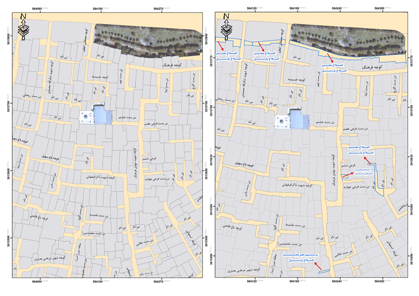
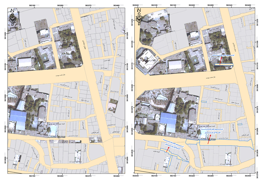
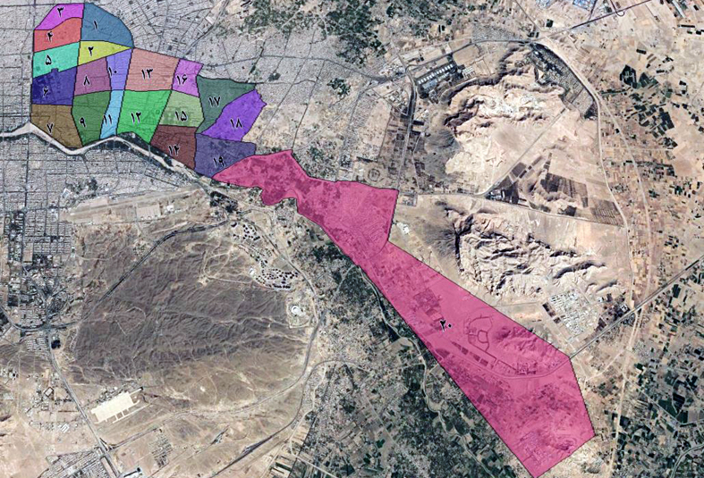
The GIS implementation project for the water and wastewater network of the first region of Abfa, Isfahan city, whose geographical area is located in regions 3 and 4 of Isfahan municipality and is divided into 20 study zones, aims to collect spatial and descriptive information related to the water distribution network, including valves, pipes, ponds and water production sources, transmission lines, storage tanks, pumping stations, other urban water-related facilities, as well as the wastewater collection and disposal system, including the collection network, manholes, wastewater pumping stations, collectors and transmission lines to the wastewater treatment plant, and to enter all collected information into ArcGIS software in accordance with standards and laws by these consulting engineers.
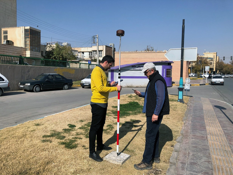
The aforementioned project generally includes three phases: spatial information collection, descriptive information collection, and urban map preparation, and GIS implementation of the water and wastewater network. In this project, after collecting spatial information in accordance with the desired accuracy and standards of the National Mapping Organization, descriptive information on the water and wastewater network facilities is collected by the executive teams in accordance with the latest forms approved by the Isfahan Provincial Water and Wastewater Company.
Descriptive data collection is carried out through a data collection system designed exclusively for these consulting engineers. The data is transferred online to the server of Sepahan Comprehensive Construction Company and stored on the relevant geodatabase.