
Studies of the first and second stages of short dams in Fereydounshahr County (Lower Maydanak Dam)
Client: Isfahan Provincial Regional Water Company
Contract start date: 2007-03-14
Brief description:
The purpose of constructing the Lower Maidanak Reservoir Dam is to store water and control floods in the region, which ultimately stores these floods for optimal use during droughts and dry seasons. By storing and storing runoff, the irrigated agricultural lands of the region will be significantly improved and the existing gardens will be developed. In addition, the rainfed agricultural lands of the region will be converted to irrigated lands, and a significant change will be achieved in the development of agriculture and the prosperity of livestock farming. The Lower Maidanak watershed, with an area of 36.2 square kilometers, has geographical coordinates of 47’11’50 to 24’17’50 east longitude and 59’45’32’ to 33’49’32 north latitude. The study area is located in Fereydounshahr County, 200 kilometers southwest of Isfahan. This region has a relatively severe to moderate topography, is located in the path of humid air fronts that enter the country from the west, and has suitable altitudes, so it has adequate rainfall.
Project Technical Specifications:
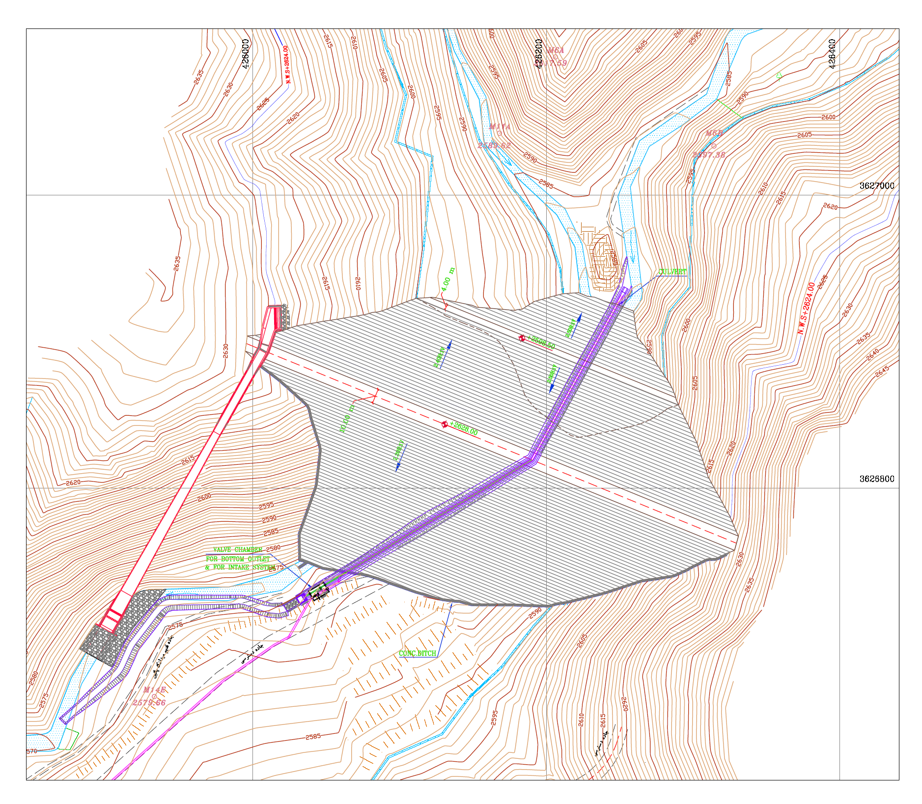
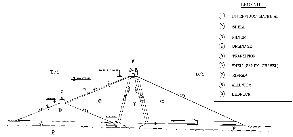
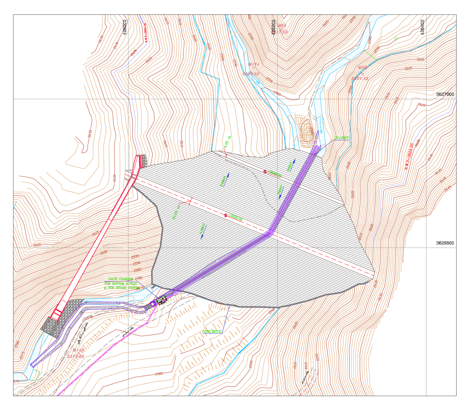
Dam type: Earthen with clay core
Dam crest level: 2628 meters above sea level
Height from river bed: 46 meters
Slope of the body: 2.4 H:1.0V
Slope of the body: 2.2 H:1.0V
Dam crest length: 361 meters
Dam crest width: 10 meters
Total body volume: 1 million cubic meters
Normal reservoir volume: 7 m m m
Normal level: 2624
Water diversion system conduit: culvert box 2.3*1.3 meters
Diversion system length: 320 meters
Diversion system location: right side of the valley
Lower catchment and drain: 1200mm diameter steel pipe
Spillway type: Lateral
Spillway width: 14 meters
Spillway length: 215 meters