
Studies of the first phase of the irrigation and drainage network of the Maydanak Dam and Darre Sib
Client: Isfahan Provincial Regional Water Company
Contract start date: 2007-02-20
Brief description:
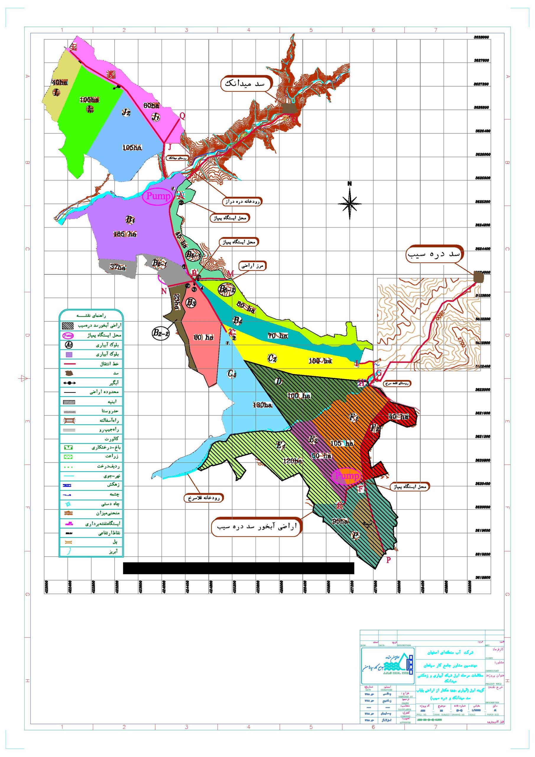
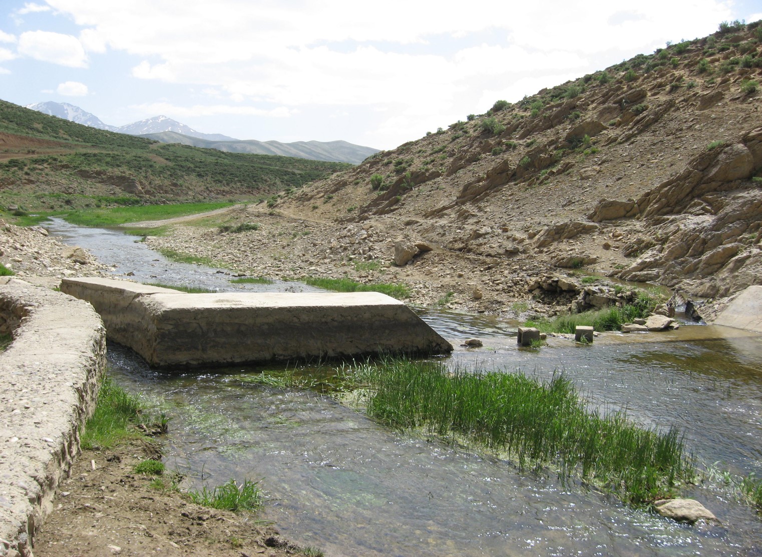
Isfahan Province is one of the central provinces of Iran, and Fereydounshahr County is located in the west of this province. The two villages of Maydanak Payin and Qale Sorkh are located 45 kilometers southeast of Fereydounshahr County. Access to the agricultural lands of these two villages is possible via the Fereydounshahr-Maydanak-Qale Sorkh asphalt road. The lands of the two villages are located between 421000 and 429000 longitudes and 3619000 and 3629000 latitudes in terms of UTM geographical coordinates. In addition, the location of the Maydanak Payin Dam on the Dareh Deraz River, located 2.5 kilometers upstream of the village of Maydanak Payin, and the Dareh Sib Dam on the Qalasrokh River, located 2.5 kilometers upstream of the village of Qale Sorkh, is predicted.
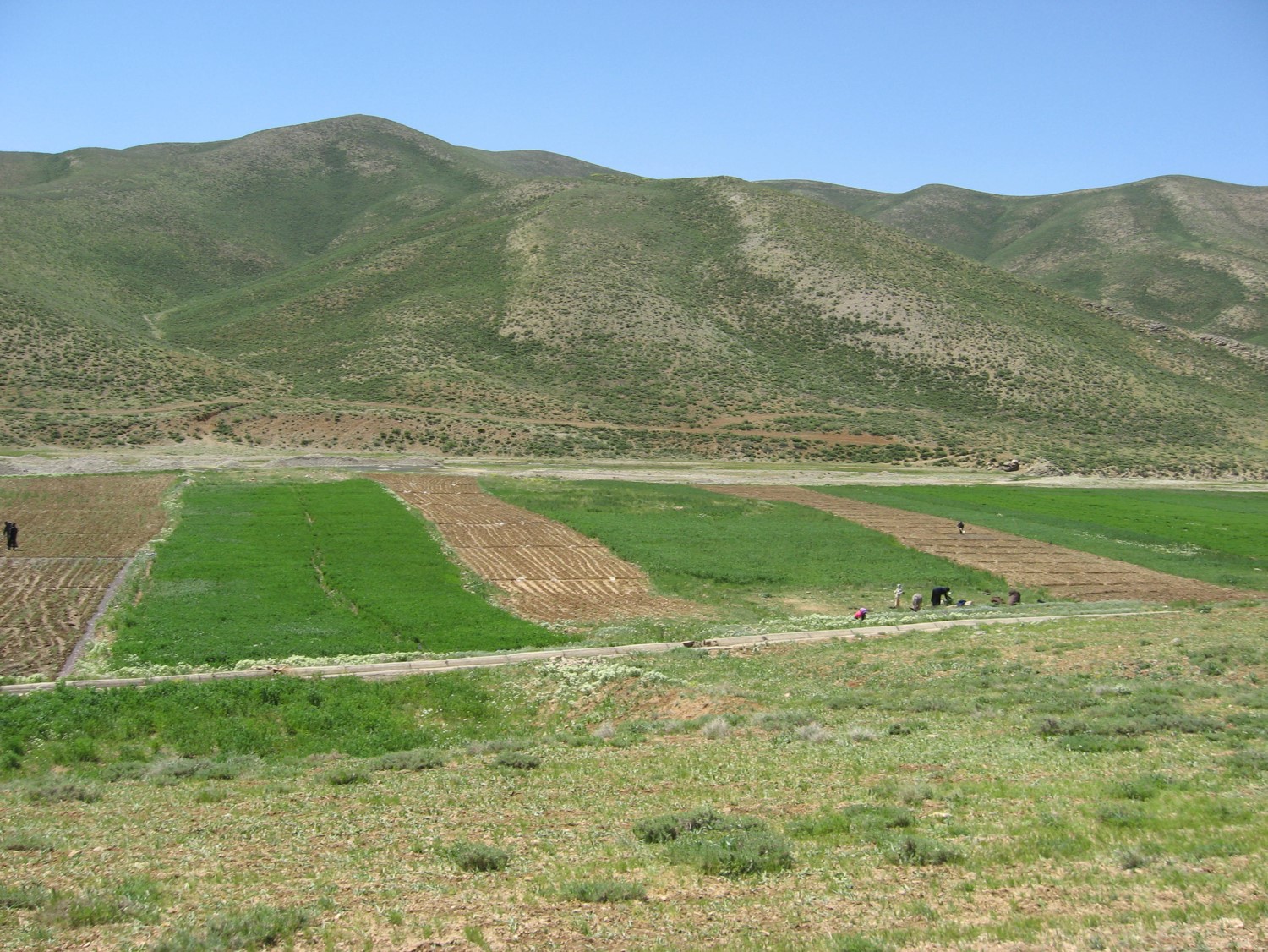
The purpose of these studies is to design an irrigation network for the lands of the villages of Maydanak Payin and Qale Sorkh and to irrigate the existing and developable lands of these villages. The agricultural lands of this region cover an area of 1550 hectares, of which 970 hectares belong to the residents of Qale-Sorkh village and 580 hectares are owned by the residents of Maydanak village.
Maydanak Dam will be built on the Dareh-e-Draz River, which is located near Maydanak village, and the residents of Maydanak village are the main beneficiaries of this river. Since the developable lands of Maydanak are in a more unsuitable condition in terms of soil quality, depth and type of soil, topography and general condition compared to the lands of Qale-e-Sorkh village, and in order to prevent social problems arising from the allocation of Dareh-e-Draz River water to the lands of Qale-e-Sorkh village and the irrigation of lands with better quality, and the impossibility of constructing two Maydanak and Dareh-e-Sib dams at the same time, in this option, the water transfer line has been designed to cover about 1035 hectares of lands downstream of Maydanak Dam, which can be considered among 1270 hectares of variable quality lands. It is obvious that the volume of water that can be extracted from the dam is not sufficient to irrigate 1270 hectares of land, so for the poor parts of Maydanak, it is possible to allocate water in the transmission line so that if the farmers of the region implement a pressurized and integrated irrigation system plan in the region, the water will be allocated to their lands, otherwise the water will be transferred downstream and irrigate better quality lands.
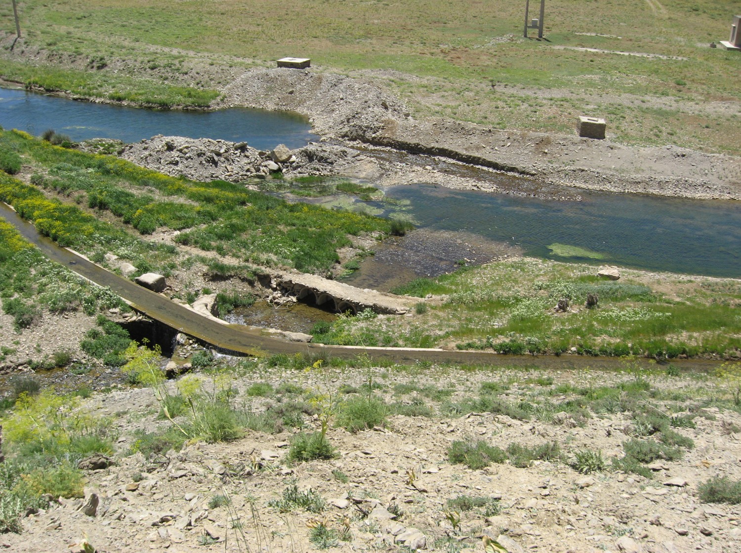
Water intake from Maydanak dam starts with a 1-meter diameter GRP pipe and continues to point A, which is the first land intake. At point A, the AJ transmission line draws water from the main pipeline and irrigates four blocks J1, J2, K, L. The irrigation method considered for blocks K, L is drip and for blocks J1, J2 is sprinkler. To transfer water from the main transmission line to these four blocks, the required water must be pumped about 90 meters at point A to be applied to the agricultural lands of this area.
Block A2 also draws water from this point, and since block A2 is also about 60 meters higher than the transmission line at point A, water needs to be pumped to reach the lands in this area. The irrigation method of this block is also drip. After watering these 5 blocks, the main transmission line continues and continues to point B. At point B, three blocks B3, B2, B1 with an area of 165, 100 and 80 are irrigated with a pipe with a diameter of 1 meter, irrigation of blocks B2, B1 is sprinkler and irrigation of block B3 is drip. By continuing the transmission line at point C, water is drawn from two blocks C2, C1 with an area of 100 and 80 hectares with a pipe with a diameter of 0.7 meters. The irrigation method considered in this method is sprinkler. At point D, block D with an area of 100 hectares receives water from the transmission line and the pipeline crosses the Qalasrukh River to irrigate the lands on the left side of this river, which are in 4 blocks F1, F2, E1 and E2 with an area of 85, 50, 90 and 40 hectares. The irrigation method considered for blocks F1, F2, E1, E2 and D is sprinkler.